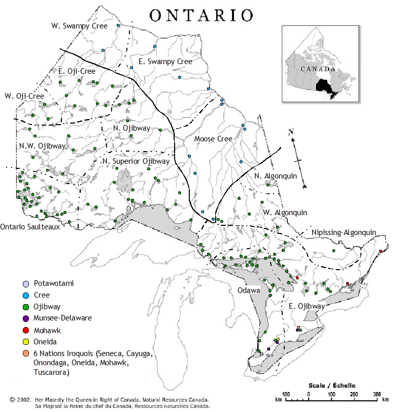
This map shows the major language groupings indigenous to what is today the province of Ontario. Each community’s language is indicated by a coloured dot. The language groupings are divided into dialect groups (thickly dashed line), which are further separated into individual dialects (thinly dashed line). Dialect groups could also be classified as separate languages: Ojibway, Oji-Cree, Odawa, and Algonquin are often labelled as languages. Although most of the language and dialect groups have fairly obvious boundaries, the dialects themselves do not. Instead of clear-cut lines, dialects slowly change from one community to the next. This is often called a “dialect chain”. Where, for example, Northern Ojibway begins and North-Western Ojibway ends is impossible to locate. The lines on this map are only approximations. To determine which nation belongs to which dialect is a matter of how one wishes to classify the dialects. In many cases, first nations close to one of the dialect boundaries on the map could be said to be on either side of the line. Very fuzzy dialect borders include: Odawa~Eastern Ojibway north of Lake Huron and Ontario Saulteaux~North-Western Ojibway Southern Ontario has had major population disruptions and movements since colonisation. Many of the original inhabitants of this area—Hurons, Neutrals, Petuns, Wenros—have either: moved to another location, merged with other nations, or disappeared as a distinct ethnic group. There is no attempt to draw language borders in this area, as most of the current First Nations here arrived relatively recently. |

Information used to build this map is from various sources.